
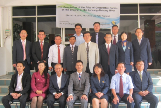
With the funding from the People’s Republic of China (P.R. China) and in collaboration with Department of Transport of Yunnan Province, the Mekong Institute is implementing a project on the “The Compilation of the Atlas of Geographic Names on the Channel of the Lancang-Mekong River”. This project includes consultation meetings for experts, a six day joint on-spot survey, and implementation of updating names on a current Atlas.
This causes difficulties in communication, which are likely to lead to faulty geographic notification among vessels, especially at the section from Suploi of Myanmar to Chiang Saen of Thailand where vessels from Lao PDR, Myanmar and Thailand are participating in shipping business. To solve this problem, it is believed that the Standardization of Romanized Geographic Names for major geographic places on the Lancang-Mekong Waterway will be conducive to smooth communication between and among vessels. As a result it will help reduce the possibility of collisions and ensure safe international navigation.
Additionally, in order to further promote the development of international navigation on the Lancang-Mekong River, P.R. China, Laos, Myanmar and Thailand are working on formulating the ‘Medium and Long-Term Development Plan of International Navigation on the Lancang-Mekong River’. This plan also serves as the preparation for phase II of maintenance and improvement of the navigation channel. The provision of consistent Romanized names for the geographic places is a prerequisite of compiling the Plan. As such, it will promote the economic development of riparian regions, benefiting the regions’ inhabitants.
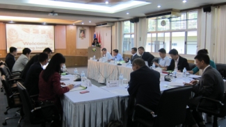
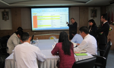
The project brings together 15 experts from transport and navigation agencies from the four countries of the Upper Lancang-Mekong River to attend a one-day consultation meeting on March 2, 2014. These officials will subsequently conduct a six day joint on-the-spot survey with the skillful facilitation and logistical coordination provided by the Mekong Institute team. The aim is to check and ensure a common understanding of locations and find a way to effectively standardize geographic names.
The geographic features include villages, towns, wharfs, ports, and rapids. The project facilitates the compilation of an atlas showing navigation channel charts with standard Romanized names of major geographic locations. The survey will then be followed by a half-day workshop to synthesize the findings, which will be used in updating the current Atlas.
At the opening ceremony, Mr. Li Hong, Permanent Representative of P.R. China to the UNESCAP, spoke about the importance of this project. His remarks were followed by the introduction of each participant, which was facilitated by Dr. Buasawan Simmala, a Senior Manager of the Mekong Institute prior to the start of the consultation meeting.
It is noticed that navigation participants from P. R. China, Lao PDR, Myanmar and Thailand use different spelling for the names or sometime use even different names for the same geographic places on the channel of the Lancang-Mekong River.


